DEVON ISLAND · JULY 2026
A closer look
at FMARS.
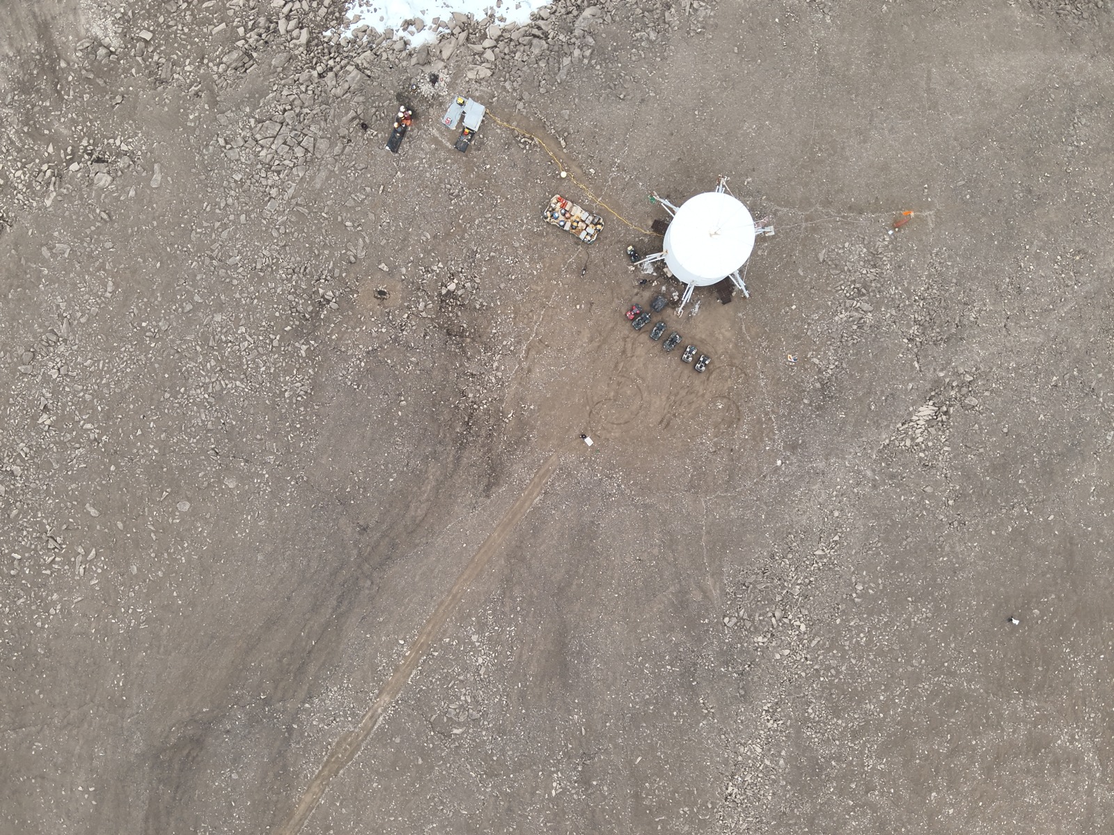
Flashline Mars Arctic Research Station. Explore Rhett’s original aerial photographs and mark places for closer study.
Explore the photographsPre-release · Under review
THE FIELD ARCHIVE
Places with a story
Click the FMARS marker above or choose a place below. Follow the photographs as a short tour, or browse the archive at your own pace.
No investigated sites are documented in this archive yet. Dated field notes, ground photos and measurements can establish that status as the archive grows. Candidate locations remain questions to explore.
AGU26 / THE POSTER
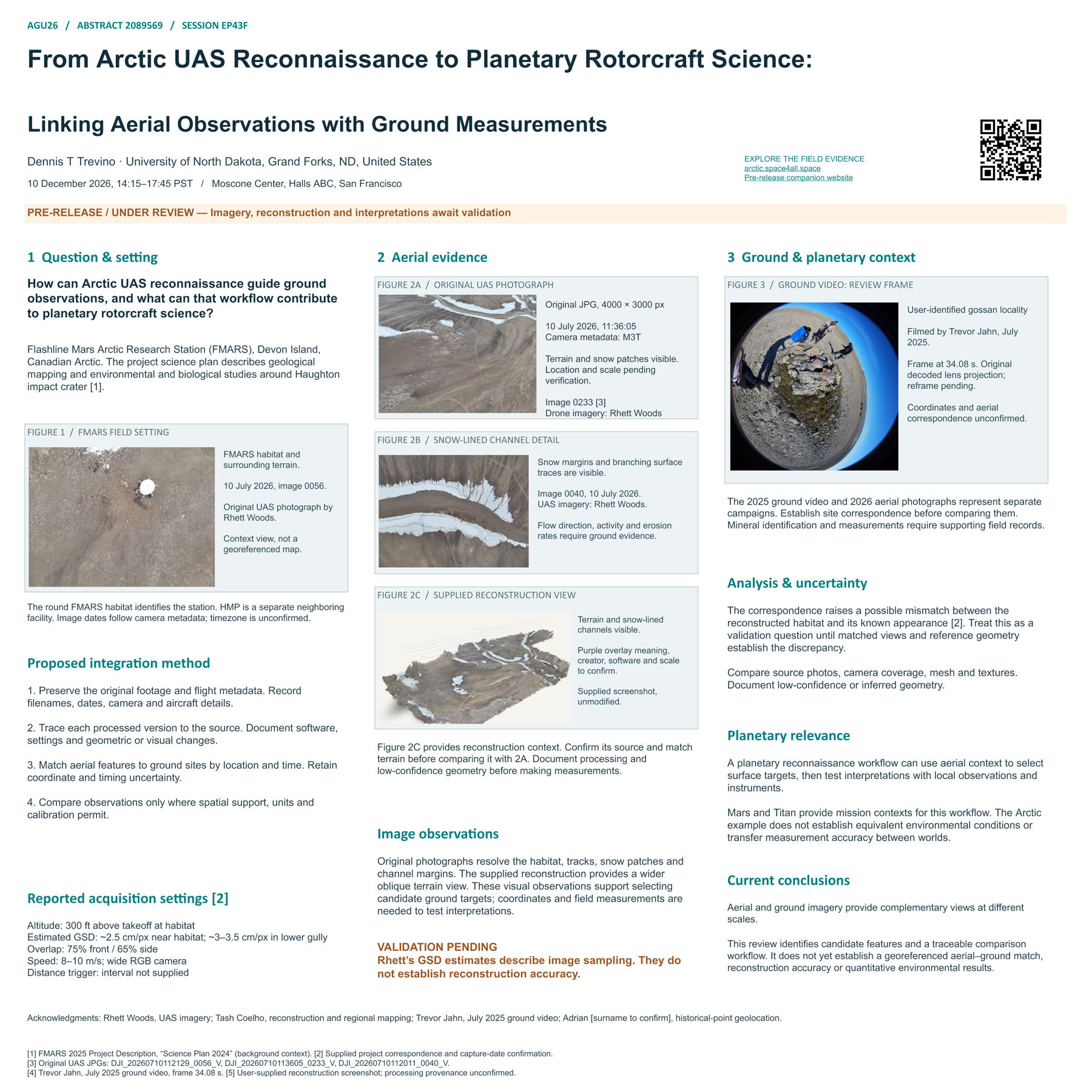
From aerial context to a ground question.
From Arctic UAS Reconnaissance to Planetary Rotorcraft Science: Linking Aerial Observations with Ground Measurements
Dennis T Trevino · University of North Dakota
Abstract 2089569 · EP43F · 10 December 2026, 14:15–17:45 PST
Take a self-guided visit
Explore FMARS, inspect the original aerial photographs, and consider which observations could test an interpretation on the ground.
Download accessible poster text
Pre-release / under review. This PDF is a 44 × 44-inch review proof, not a press master. The comparison has not established a georeferenced aerial–ground match or quantitative environmental results.
GROUND EVIDENCE / JULY 2025
A closer look at the outcrop.
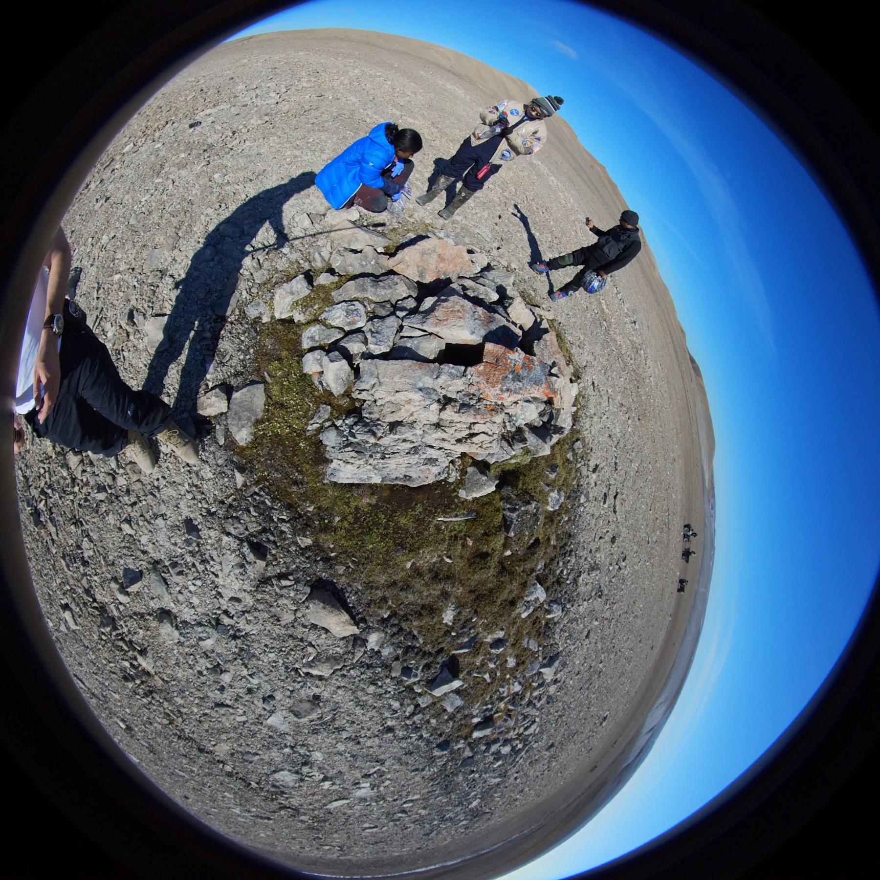
A separate field campaign
Terry identifies this as footage near a gossan locality. Its coordinates and correspondence with the 2026 aerial coverage remain unconfirmed. Surface appearance alone does not establish mineral composition or active boiling.
The original video remains in the project archive. A calibrated stitched or reframed export is needed for the final scientific figure.
What would link the observations?
A dated site record with verified coordinates, a matched ground view, and measurements with units and methods would let us test a spatial comparison.
THE RESEARCH QUESTION
What can we observe from above,
and what needs a closer look on the ground?
Aerial images give spatial context. Ground observations can test an interpretation. This companion lets you inspect the source material while the team checks the reconstruction and prepares the scientific results.
01 / SOURCE IMAGERY
Explore the photographs
Start at FMARS. Scroll or double-click to zoom at a chosen point.
Drag to pan. Use “Mark a study point” to place a pin.
Zoom magnification is a display control. It does not measure ground distance or establish positional accuracy. Capture times have no confirmed timezone.
STUDY SITES
Pick a place. Keep its evidence.
Mark a point in the photograph above. Its original-image pixel location stays attached to the source file.
Pins identify points in a photograph. Ground latitude/longitude must come from a separate documented source until a georeferenced model is available. Camera GPS is shown only as provenance. Added ground coordinates remain user-supplied and unvalidated.
Records save in this browser only. Export a backup to share them or move devices. Photo-only points export with no geographic geometry.
02 / A SELF-GUIDED VISIT
Three questions
to take into the field
Optional device-generated narration. The full text is below.
What is directly visible?
Look for the boundaries of snow patches, terrain texture and the shapes of structures. Describe the image before interpreting the process.
What did the software infer?
A reconstruction estimates geometry from overlapping views. Compare a model with original photographs, especially where coverage is incomplete. The processing software and version remain to be documented.
What would confirm the interpretation?
A matched ground photograph, a georeferenced observation or an independent checkpoint could help test it. Ground measurements and reconstruction validation are pending.
03 / RECONSTRUCTION REVIEW
Original evidence. Estimated geometry.
The next comparison
The supplied reconstruction screenshot shows terrain texture and snow-lined channels. Its creator, software, scale and purple overlay meaning remain unconfirmed. No new 3D reconstruction has been produced for this companion.
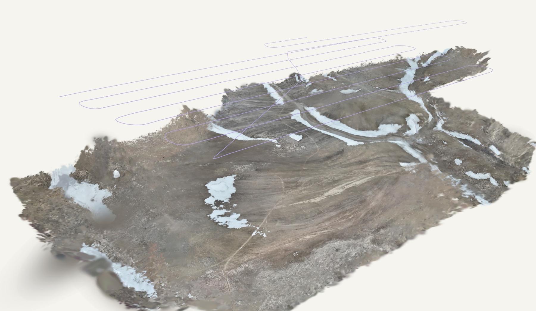 A quantitative comparison requires documented source lineage, registration and independent checks.
The existing project model
Tash Coelho created the online 2026 reconstruction using Rhett Woods’s drone imagery. Its geometry and processing history have not been independently reviewed for this companion.
Open the existing 3D model ↗Open the regional context map ↗
Regional map: Tash Coelho, incorporating project data and historical points geolocated by Adrian (surname to confirm). Attribution supplied by Dennis T Trevino.
External model inspected: dragging rotates the terrain. No point-coordinate readout or study-site tools were visible. Its geographic registration remains unverified.
REPORTED ACQUISITION
How Rhett collected the imagery
- Flight height
- 300 ft above habitat takeoff elevation
- Overlap
- 75% front / 65% side
- Speed & camera
- 8–10 m/s / wide RGB
- Estimated image sampling
- ~2.5 cm/pixel near habitat; ~3–3.5 cm/pixel in lower gully
Operator-reported settings from the supplied correspondence. Coverage and linkage to each flight remain to be checked. Sampling distance does not establish model accuracy. Constant height above the takeoff point does not imply constant terrain clearance.
KEEP THE CONVERSATION GOING
What would you investigate?
This draft tool does not send or store your question. Save it to bring to the presenter or share later.